12:08 am, Central Time - Omaha Nebraska. Ten minute station break for the night owls on board. It is a fortunate curiosity to this lengthy ride that all of the most amazing scenery is to be seen during the daylight portions of the trip. Most of the night riding was through corn fields and endless wheat fields dotted with the occassional small town and the intermittent clanging of the crossings. It may sound like a nightmare but the charm of rail travel is something you really need to experience.
12:14 am Depart Lincoln, Nebraska
LINCOLN The 400 ft., 14-story ten million dollar state capitol building, the "Tower of the Plains," dominates the city, on the right. The golden dome has a statue at the top which is not of a University of Nebraska football coach, as many have suggested, but the symbolic "Sower." The state fair grounds are to the left. The University of Nebraska campus and stadium are visible from the train, on the right, just east of the station.
Platte River Along the historic Platte River, the Mormons traveled the north bank for several hundred miles in their quest for the holy land. The Pony Express and Oregon Trail followed its south bank.
1:47 am Hastings (Grand Island) Nebraska. Station stop.
2:34 am Holredge, Nebraska. Station stop.
3:43 am McCook, Nebraska. We move our clocks back one hour, or we did before we went to sleep.
Colorado/Nebraska State Line (45 Min/70 Min)
Note: at the Colorado/Nebraska State Line (45 Min./70 Min.) change your watch between Mountain and Central, one hour later if going east, one hour earlier if going west.
5:05 am Mountain Time - Fort Morgan (Sterling), Colorado. Station stop
Commerce City (20 Min/65 Min) On the northeastern edge of Denver, the train passes through Commerce City. This industrial suburb of Denver has the nation's largest sheep market. It also has a number of sugar beet factories and cattle yards which line the tracks.
7:15 am - Arrive- Denver, Colorado. We hve 50 minutes in Denver Union Station. That's enough time to get an omelette.

DENVER Denver's skyline is notched with an impressive array of modern buildings, many built by the energy industry. Historic Larimer Square is only a few blocks away from the station. The 24K gold domed state capitol contains the entire world's supply of Colorado Onyx, and the 13th step leading to the capitol is one mile high above sea level. Denver is nestled up against the foothills of the Rockies on the barren High Plains. This is a refueling and servicing stop for the train.
8:05 am - Depart - Denver, Colorado. The train has just been serviced and is all sparkly and fresh smelling again. We also picked up a double crew for the upcoming run. Federal law prohibits an engineer from driving more than 6 consecutive hours so for long runs or runs such as this through difficult terrain, trains often carry a backup engineer who, presumably, rests until needed.
Rocky (105 Min/32 Min) Railroad cars filled with sand protect freight from winds that occasionally reach 100 miles per hour at a point called "Big 10" Curve. As the train approaches Arvada, a Denver suburb straight ahead, note the tall peak to the right. This is Mt. Evans, at 14,264 feet.
Coal Creek Canyon (100 Min/40 Min) is to the right as the train passes over a small bridge. People still pan for gold in Century City, not too far from this canyon. The tracks can be seen far below as the train winds between the front range of the Rockies and Denver.
Plainview (95 Min/45 Min) From this area at night, 1,500 feet above Denver, there is a spectacular view of the city. Day or night, it is possible to see the Rocky Flats nuclear arms manufacturing plant, to the left, and the city of Boulder to the north. Beyond Denver to the east stretch the Great Plains.
South Boulder Canyon (45 Min/50 Min) This area is the location of the Roosevelt National Forest and the Gross Reservoir, with its 340 ft high dam which supplies Denver with fourteen billion gallons of water. Watch for deer and elk in this region. The train passes through 29 tunnels in this area, the shortest only 78 feet and the longest , the Moffat Tunnel, 6.2 miles long. The track grade is a steady 2% between here and Denver. A wooden flume on the far canyon wall, on the left, once sent logs to the Eldorado sawmill.

Moffat Tunnel (10 Min/95 Min) The train crosses the Continental Divide, at an altitude of 9,239 feet, under Rollins Pass, beside James Peak, 13,260 feet above sea level. On the east side, the old train tracks that crossed Rollins Pass can be seen above. This route was called the "Giant's Ladder," which reaches the dizzying height of 11,000 ft. The journey around James Peak used to take more than 5 hours until the Moffat Tunnel was built, cutting the travel time to just over 10 minutes. The tunnel, 6.2 miles long, took 5 years to construct, opening in 1928.
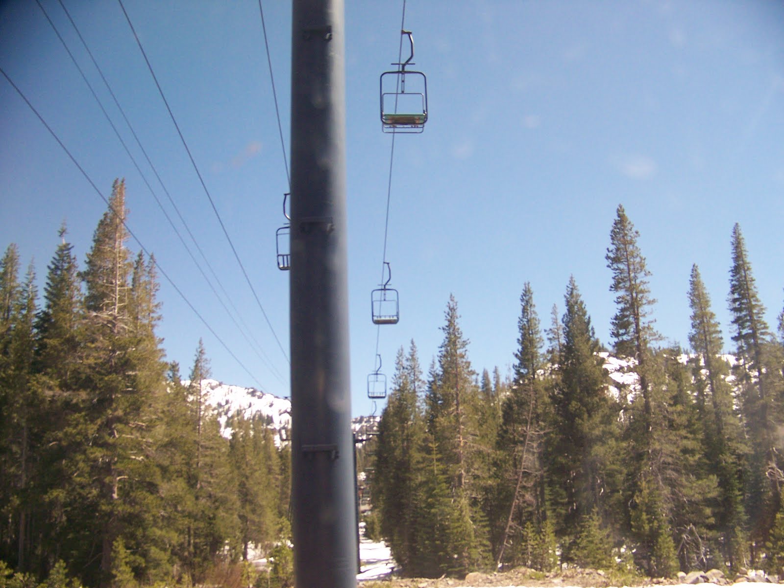
Winter Park Ski Resort (10 Min/105 Min) Located at the western portal of the Moffat Tunnel, this ski area was built as part of Denver's mountain park system. The slopes, to the right, come right up alongside the railroad.
10:07 am - Fraser - Winter Park, Colorado. Station stop.

WINTER PARK (Fraser) This is the station for the nearby Winter Park Ski Resort. The clear and cold Fraser River cuts a swath through Arapahoe National Forest and Fraser Canyon. This was the favorite fishing spot for President Eisenhower, particularly the mountains on the right. The town of Fraser proudly calls itself the "Icebox of America" because of its winter temperatures of -50 degrees Faranheight. The Devil's Thumb is a rock formation on top of the ridge to the left.
Tabernash (15 Min/10 Min) was named for a local Indian chief. It was also a station where "helper" engines were added for the long, steep climb over Rollins Pass prior to the boring of the Moffat Tunnel.
Fraser Canyon (5 Min/18 Min) The train follows the Fraser River through the remote canyon.
10:37 am - Granby, Colorado. Station top.
GRANBY This station is the gateway to Rocky Mountain National Park. The vast meadowlands in this area make up a region called Middle Park. Evidence of aboriginal people has been found at nearby Windy Gap Dam dated at 3000 B.C.-1200 A.D., predating modern Indians. Silver Creek ski area and Winter Park are across the valley to the right.
Byers Canyon (162 Min/16 Min) An occasional buffalo can be seen among the cattle in this area. Byers Canyon is filled with unusual "pagoda" rock formations high above the tracks. The red and gold rocks have been shaped by water and wind into an infinite array of delightful patterns.

Kremmling (140 Min/35 Min) The town of Kremmling is to the left of the train. Vail, Colorado, is 70 miles away on the other side of beautiful Mt. Powell, 13,534 feet, to the right.
Gore Canyon (85 Min/40 Min) The towering sires of the Gore Canyon have rock walls reaching 1,500 feet above the river. The lofty peaks to the right belong to the Gore Range and reach elevations of over 13,000 feet. The train follows Gore Canyon for 22 miles, and much of the rugged canyon can be reached only by train.
The Red Canyon(60 Min/115 Min) The Red Canyon has vivid and unusual rock formations, which helped inspire the Spanish to name this country and the river "Colorado" -- red.
Dotsero (45 Min/140 Min) A survey of the Colorado River began in Dotsero in 1885. The survey team marked their maps with a ".0" ("dot zero") at the junction of the Colorado and the Eagle Rivers and it has been called Dotsero ever since. This is also the approximate midpoint of the Zephyr's 2,427 mile journey.
Glenwood Canyon (1 Min/150 Min) Just outside of Glenwood Springs, the train enters Glenwood Canyon and the White River National Forest. The spectacular high cliffs are dotted with aspen and evergreen trees. The colorful jutting rocks form a myriad of unusual shapes.
1:53 pm Mountain Time - Glenwood Springs (Aspen), Colorado. Station stop.
GLENWOOD SPRINGS Roaring Fork River meets the Colorado on the right. The infamous gunslinger Doc Holliday is burried here. Glenwood Springs was also a favorite of Teddy Roosevelt, who stayed at the Colorado Hotel and enjoyed the revitalizing waters of the Yampa Hot Springs, now one of the largest outdoor pools in the world. Other recreation in the area includes fishing, backpacking and skiing, with Aspen and Redstone resorts just a short drive away. White water rafters salute the train while riding the rapids on the Colorado

New Castle (90 Min/29 Min) In 1896, an explosion at the nearby Vulcan mine killed 54 miners. The blast threw mine timbers 400 feet into the river. A second explosion in 1931 leveled the works, killing every man, a total of 37 fatalities. The mine is still on fire. Baxter Mountain, 11,188 feet, is to the left.
Grand Valley (50 Min/68 Min) The Parachute Mountains, to the left, are named for the billowing parachute shapes that they suggest.
De Beque-Palisade (39 Min/80 Min) The huge mountain toward the east is the Grand Mesa, the world's largest flat-top mountain. The De Beque Palisade area produces over three million bushels of fruit each year, including peaches, pears, apricots, apples and cherries.
4:10 pm - Grand Junction, Colorado. Station stop.

GRAND JUNCTION The Gunnison and Colorado Rivers meet here. Grand Junction is the gateway to Mesa Verde National Park, the Colorado National Monument and Grand Mesa National Forest, enclosing the city on each side with stately mountains. The fertile Fruita Loma Valley, where Grand Junction is located, is a major producer of fruits, vegetables and minterals.
Utah/Colorado State Line The state line between Utah and Colorado is marked at Utaline by a sign painted by railroaders on the canyon wall to the left.
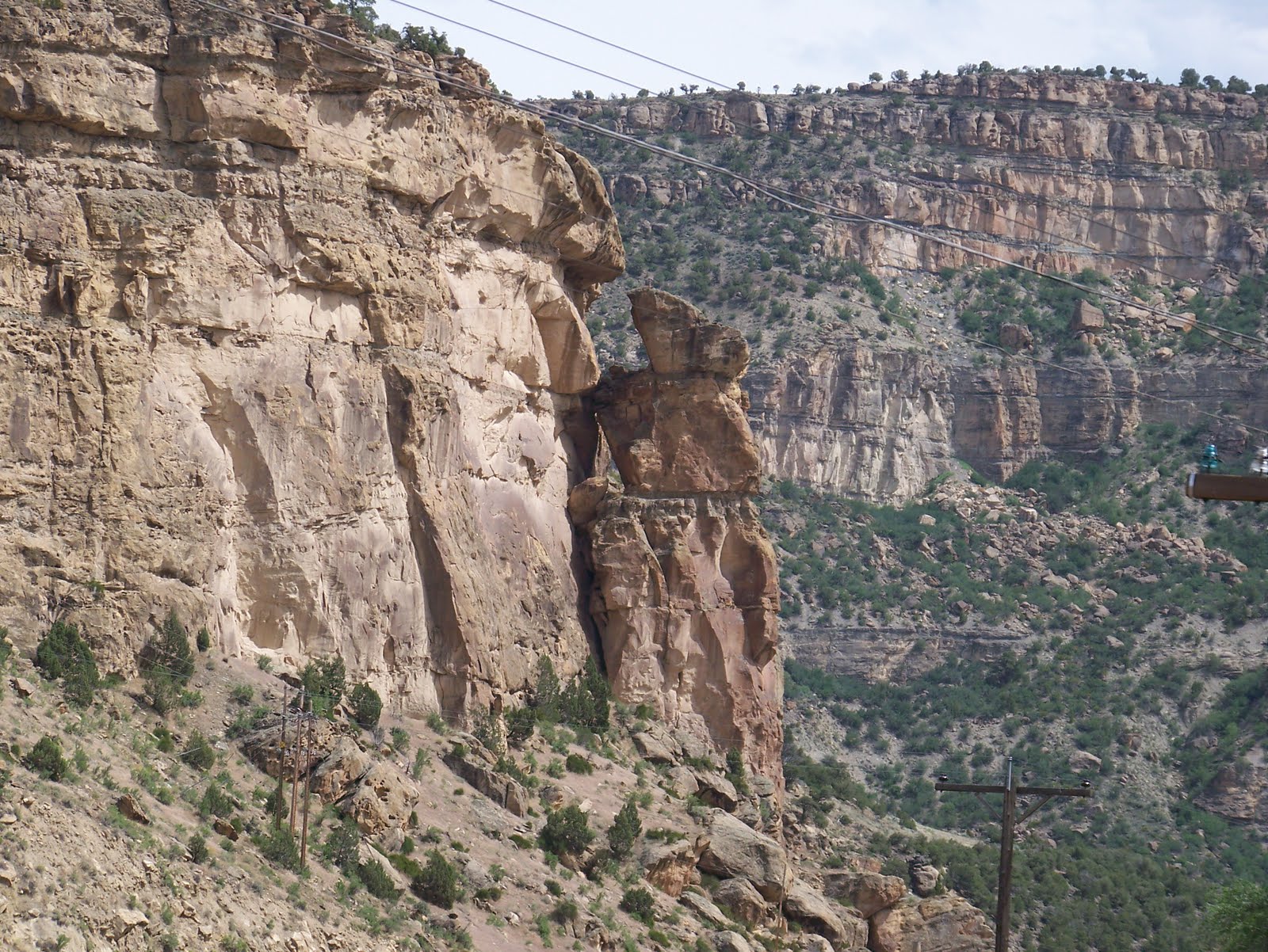
Ruby Canyon (40 Min/18 Min) At this point, the tracks begin to follow the route of the Colorado River for 238 miles. Enter the beautiful red rock formations of the Ruby Canyon, the eastern "gate" of the Utah desert. The canyon was formed by the Colorado River carving its way through the Uncompahgre Plateau. Water, wind and eons of time have hewn smooth textures and fascinating shapes in the striking red stone. The swift river and the elements continue to create new indentations in the canyon walls, etching a record of nature's events.


THOMPSON This desolate region, called the nation's atomic warehouse because it is rich in uranium, is also the gateway to Canyonlands and Moab, the Arches National Park, Manti-La Sal National Forest, and Dead Horse Point. The eroding mesas on the left are the Book Cliffs.
5:58 pm - Green River, Utah. Station stop.
Green River (70 Min/27 Min) At 4,075 feet, this is the lowest altitude en route from Salt Lake City to Denver. The town is known for its cantelopes and watermelons. The mountains to the right are Mt. Marvine, 11,600 feet, and Thousand Lake Mountain, 11,306 feet. This is also prime "jackalope" country. These hare-like, antlered creatures are legendary for their size and proliferation.
Price (7 Min/93 Min) It may be small, but Price is the largest town until the train reaches Grand Junction. The Book Cliffs on the left extend all the way to Colorado. Composed of sandstone and shale, they provide evidence that this whole valley was once under water.
7:20 pm - Helper (Price), Utah. Station stop.
HELPER Additional "helper" locomotives are added to freight trains to help them over the mountains, giving this railroad town the name Helper. Local coal is plentiful enough to supply the U.S. for 300 years.
Castle Gate (108 Min/10 Min) A rock formation in front of the train resembles a gigantic castle door that seems to open and close as the train enters and leaves the mountains. High up on the hill to the left is Balancing Rock with a makeshift flag. The mass of machinery on the left is a processing facility for coal.

Soldier Summit (55 Min/50 Min) The train curves back three times as it winds through a series of horseshoe curves and bends on the way to the summit of the Wasatch Range, 7,440 feet high. To the right is the final resting place of some of the Union soldiers in Johnson's Army, burried here in 1860. This area has a number of abandoned mine shafts such as the one on the right. Also on the right is Davidson Canyon, one of the prettiest in Utah. Once over the top of the summit, the train enters Price River Canyon.
Thistle (26 Min/92 Min) This tiny village on the Spanish Fork River was destroyed in a mudslide in April, 1983. Part of the original railroad line was also buried. Roofs and parts of houses can be seen on the right side of the train. The railroad's main route was blocked for three months until a six-mile bypass could be built, including a new 3,000 ft. tunnel through Billy's Mountain.
9:26 pm - Provo, Utah. Home of the Osmonds. Station stop.
PROVO Utah's third largest city has an abundance of agricultural and mineral wealth. It is situated at the base of "Y" mountains, part of the Wasatch Range. It is the home of the nation's largest private university, Brigham Young University and the Osmond Entertainment Center where Donnie and Marie Osmond taped their shows. Outside of Provo is the entrance to Uinta and Manti-La Sal National Forest. The train enters the Wasatch Mountains and follows the river up the Spanish Fork Canyon.
Geneva (51 Min/9 Min) The steel mills of Geneva Works are on the left with the 11,750 feet high Mt. Timpanogos, the "sleeping princess," behind it. The tall mountain on the right at the south end of the valley is Mt. Nebo.
Riverton (40 Min/20 Min) The multicolored tailings that can be seen on the mountains to the right of Riverton are the vast workings of the Kennecott copper mines in the Bingham Canyon that was once one of the largest open pit mines in the world. The Jordan RIver flows from Utah Lake, which is on the right side of the train.
11:05 pm - Arrive - Salt Lake City, Utah. We have travelled 1608 miles so far. We have 25 minutes while the train is refueled and serviced.
SALT LAKE CITY The wide streets of Salt Lake City lead downtown to Mormon monuments including Temple Square, the Seagull Monument, the six towers of the Mormon Temple visible from the station and the Beehive House. The headquarters for the Church of Jesus Christ of Latter-day Saints is located here as well as a world renowned genealogical research facility. The prosperous Salt Lake Valley has one of the prettiest natural settings in North America. Today it is home for a growing electronics industry. Salt Lake City is the connecting station for the California Zephyr and the Desert Wind from Los Angeles.
11:30 pm - Depart - Salt Lake City, Utah.
Note: At the Nevada/Utah state line, change your watch from Pacific to Mountain time; one hour ahead if traveling east, one hour back if traveling west. West of Salt Lake City, the train crosses the Bonneyville Salt Flats and follows 15 miles of the Great Salt Lake.

We end this day somewhere along the shores of the Great Salt Lake driving toward the Nevada state line and the desert ahead. Elko, Nevada is our first stop on Day 5
